




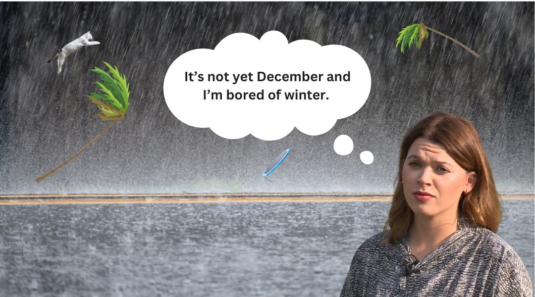
Alas, the lovely settled spell of weather is now very much a thing of the past and we can expect some turbulent few days thanks to Storm Bert.
Bert will make his appearance very much known from this morning with gusts of up to 70mph and torrential downpours.
Expect travel chaos and all outside plans to be well and truly buggered (unless you’re mad, then crack on).
If you haven’t already tied down your bins, your trampoline or your peculiar garden ornaments – then more fool you.
And if you sit there going “the Ben would go in this weather”, no I don’t believe then Ben would have sailed the Irish Sea in 70mph winds, and if it did you’d sure as hell remember it.
Do you know what else leads to travel chaos, other than Bert, mercury retrograde… and guess what we are about to enter? Mercury retrograde.
Mystic Moz
“P**s off with your hocus pocus nonsense, Charlie”. No, because if I have gone from the most nonbeliever to living my life by it, you can start to understand it too.
This is our fourth mercury retrograde of the year and we are currently in its shadow period, it will officially enter retrograde on Monday (November 25).
Unlike the others we have had this year, this one will be in the sign of Sagittarius. Known as the seeker of the zodiac, it is a student of life and an explorer of truth.
It’s all about learning, healing, growth – so if you’ve had a crappy few weeks and things just aren’t going to plan, thats ok.
It is the perfect time for some self reflection, evaluation, and figuring out your authentic you, with a little sprinkle of this sucks and can it be over yet.
Mercury will finish doing its thing on December 15, so hopefully by then we all have a wee bit more clarity.
Back to Bert
Sorry to those who only came here for Storm Bert, I will go into some detail on him too.
Right so as we’ve all been freezing our titatas off this week in the cold conditions, Big Bad Bert (BBB) plans to change that a little, as unlike our pals in the UK we will be creeping out of single figure temperatures.
The UK Met Office said it expects the storm to bring “heavy rain, strong winds and disruptive snow to parts of the UK through the weekend” and potentially cause travel disruption and flooding.
Ronaldsway Met Office say this morning will then be very wet and windy with gusts of 60-70mph and persistent, heavy rain (20-30mm, risk 40mm on hills).
Localised flooding is likely where drains are blocked, with difficult driving conditions.
Of course there is a risk of travel disruption by land, sea and air – island life in the winter doing its thing.
There is also a risk of structural damage/fallen trees/garden shed deaths/wheelie bins in wrong parishes etc.
However, the rain will ease in the afternoon as winds swing to the south, not quite as strong but still strong to gale force.
This is where Bert decides to play with our minds, as it will be very mild, and temperatures are expected to reach 14°C.
Day Two of Bert
Day two of Bert is likely to be slightly kinder in terms of rainfall, but still rather blustery.
It is forecast to be bright with sunny intervals and isolated showers, although still very windy.
The wind will be a south or SW 30-35 gusts 45-55, increasing 35-45 gusts 50-60, veering SW 25-35 gusts 40-55 later.
The gales and severe gales bring a risk of disruption to travel (land/sea/air), a risk of structural damage/fallen trees and risk of coastal overtopping.
Temperatures are still warm enough with 13°C forecast.
Outlook?
If you’ve made it this far, thanks. But I’m assuming you’re either my mum, a weather fanatic, or someone questioning why I do the weather and still have a job. Fair enough.
What’s in store for us on Mercury Monday? All seasons in one day.
There will be sunny spells and isolated showers, with gusts of up to 55mph at times.
The good news is the wind will then start to drop and we can stop being on red alert for ferry cancellations! Although they’re a brilliant news filler and comment generator, they are a bit of a pain the arse.
The wind will be SW 25-35 with gusts of 40-55, veering NW 20-25, decreasing 15-20 later.
An Average Winters Day
Tuesday (November 16) will be an average winters day. It will be bright at first but turning cloudy with occasional showers developing.
Thankfully the wind has calmed down and is forecast to be a NW 15-20, veering NE 10-15.
Minimal rainfall is forecast with 0-5mm on the way.
Batten down the hatches and hopefully none of us get blown away this weekend.
Charlie x

7 Comments